
Let me give you some logistics first. The total distance of the Milford Track is 53.5 km. You can only hike this in one direction commencing at Glade Wharf at the head of Lake Te Anau and finishing at Milford Sound. It takes four days to complete the hike, however you may opt to make it shorter if you walk faster and in much more fine fettle. You can either choose to have a guided walk and pay over $NZ1.5k or decide on doing an independent trek which is way easier on the pocket. We did the latter. There are three huts on the track where independent hikers use communal rooms and where there is no shower facility. Tickets for the accommodations usually sell out on the opening of the summer hike season.

I went with a big group of hiker friends to trek the Milford Track which is a part of Fiordland National Park. A friend, Beah Ulama, who has an extraordinary flair for organizing and arranging itineraries point by point knocked this adventure into shape for us. The rest of us just had to be there, pay our dues and enjoy the exciting escapade with everyone.

Anyway, we started the journey from Te Anau Downs where a Fiordland Express boat took us to Glendale Wharf, the starting point of the track. Even before we made the scene to Glendale Wharf, our eyes were already entertained by the impressive vista in all corners of Lake Te Anau. We had an hour to have a ball in the water as we were transported to the head of the lake.
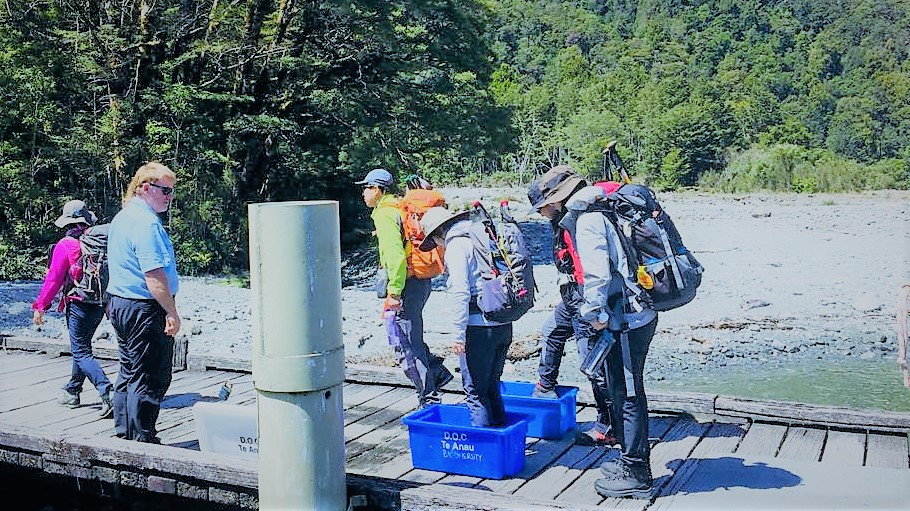
Shortly before we disembarked the watercraft, we hopped on a container of disinfectant solution as required by the Department of Conservation to limit the spread of dydymo and other freshwater pests to water tributaries in Milford Track that are prevalent in Lake Te Anau. As soon as we left the edge of the lake, we had to apply copious amount of sandfly repellent as we had been attacked instantly by these people-biter insects. Yes, there are awful lots of them in the track. So if you’re thinking of taking this great walk as well, sandfly repellent is a must to bring with you. They don’t carry infectious diseases though.
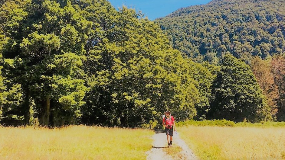
Day 1 of the hike was a walk in our own sweet time. The distance from Glendale Wharf to Clinton Hut was only 5km which took us about two hours or so to do including stopping for photographs. It was timed for 1.5 hours but we had many a moon in our hands to take in the views.

One of the most interesting parts of the Milford Track which is by the way dubbed as the finest track in the world, are its rivers and side streams. However, an extra care is essential because rain can easily swell up the tributaries and can make the track seriously dangerous. There have been a few lives claimed by the bulging water in the past so it is of utmost important that hikers do their research especially on weather conditions and heed to the warnings of DOC rangers . There are tracks that trampers simply cannot cross when the rivers rise and the current is strong.

Since the first day was just a leisurely walk, we made a side trip to the Wetland Boardwalk which is only a few minutes away from Clinton Hut. The boardwalk is surrounded with delicate but diverse flora so trampers are advised not to step beyond the boards. From here, we had a great glimpse of the surrounding mountains. We got an impression of what we signed for as well.

Even cold showers is unavailable in multi-day hikes and in remote places like Milford. As soon as we hit Clinton Hut, we scurried frantically to a swimming hole nearby. Oh boy, even if the water felt quite Siberian, we took a dip to scrub off the sweat we reluctantly manufactured on that couple of hours of meandering. Personally, my body was numbed by the freezing water that I did not feel whether or not I have had suffered from sandfly attack! We got a charge out of it though like one who takes sheer delight on eating ice cream in the middle of winter.

Clinton Hut was our dwelling on our first night in Milford Track. Like any other huts on NZ great tracks, Clinton Hut welcomes independent trampers with bunks and mattresses. There are no power so our torches were ready when we were caught by darkness still up and unwilling to lay in bed yet. The kitchen has lighting and heating though but only until 10PM. Water supply in the toilet and kitchen comes from the upstream. Water is generally safe to drink.

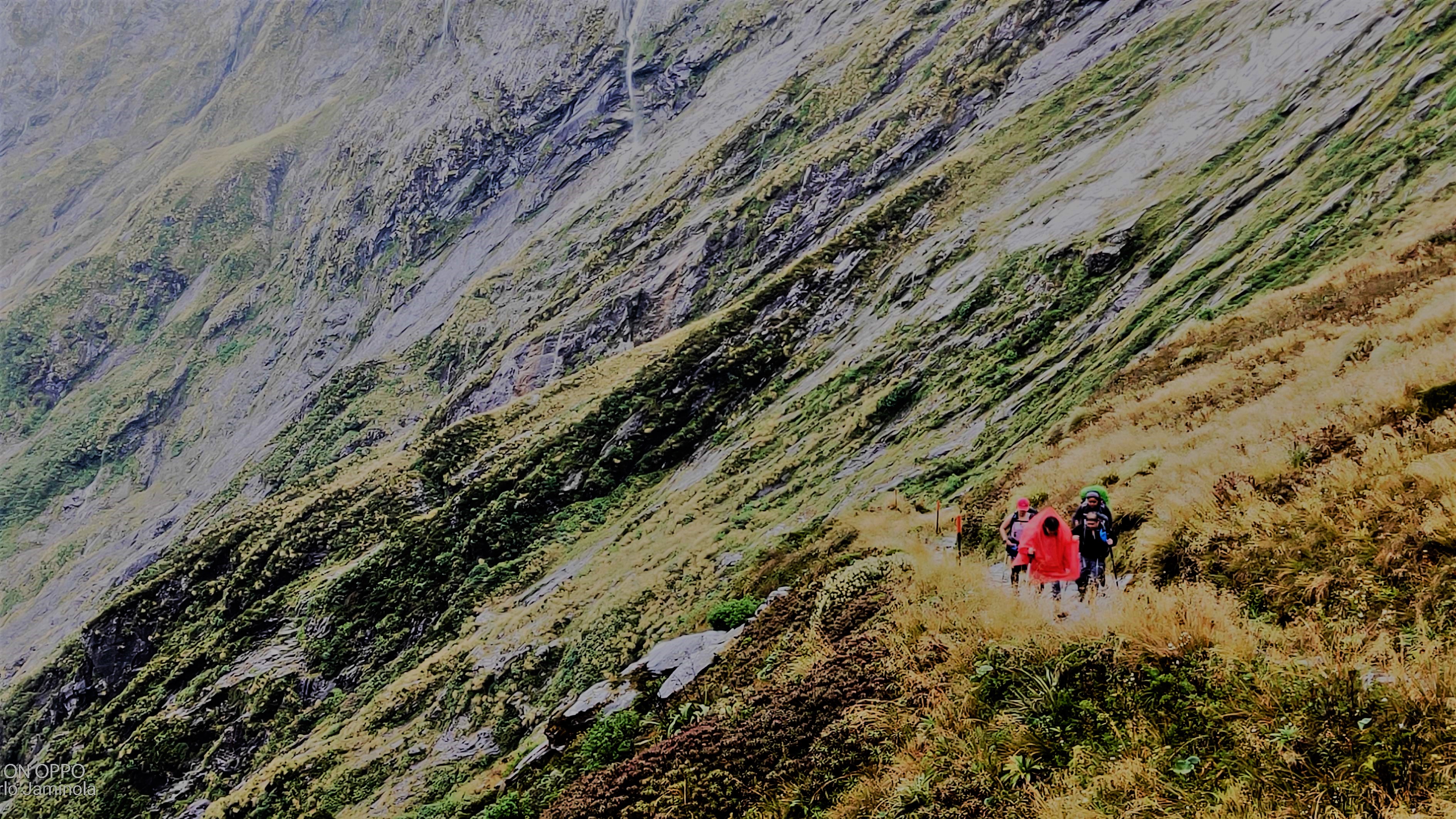
We counted ties quite early on our second day. The goal was to complete the 16.5 km distance from Clinton Hut to Mintaro Hut. A few of us whose pace were quite slow knew that we would arrive at the next hut well beyond the recommended time of 6 hours. I actually wonder whether the suggested stretch of time to take the distances we took was established for people with longer legs, thus with giant strides! Anyhow, the weather was great, we were lucky! The track was a gradual ascend through lush forests paralleled by Clinton River.
At about past midday, we reached the base of McKinnon Pass and did a brief excursion off the main route to Hidden Lake. We nibbled our lunch there and took a little breather before we made headway. We still lathered ourselves with sandfly repellent as these insects remain prolific everywhere. Oh, don’t worry when mother nature calls because there are toilets along this track.
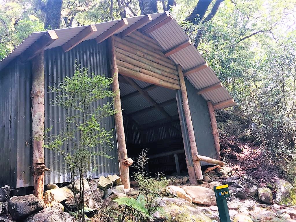
As we forged ahead, we passed by the Bus Stop. This is where trampers are advised to stay when the rivers flood the track. The weather changes unpredictably in the Milford area. That is why trampers should equip themselves with appropriate gears and equipment suited for the changing weather conditions and adhere to the advice of DOC Rangers should the weather becomes treacherous. Rangers give briefings to hikers once they check in the hut.

From the Bus Stop, we carried forward across a heavily bouldered track in still ascending fashion. I was tempted to complain how painfully exhausting this was but I kept myself from fretting because one of our friends mustered her strength to do the tramp with us despite her sore back and hips due to big C but she was just grateful to be able to do it.
As we climbed up through the boulders, we met a ranger who was fixing some orange markers that seemed to have been displaced. She said that just a week ago, there was a heavy downpour and the water completely engulfed the area. The water in the zone subsides briskly as it surges speedily. A couple of hours later, we winded up in Mintaro Hut where most of our companions were already there getting forty winks.
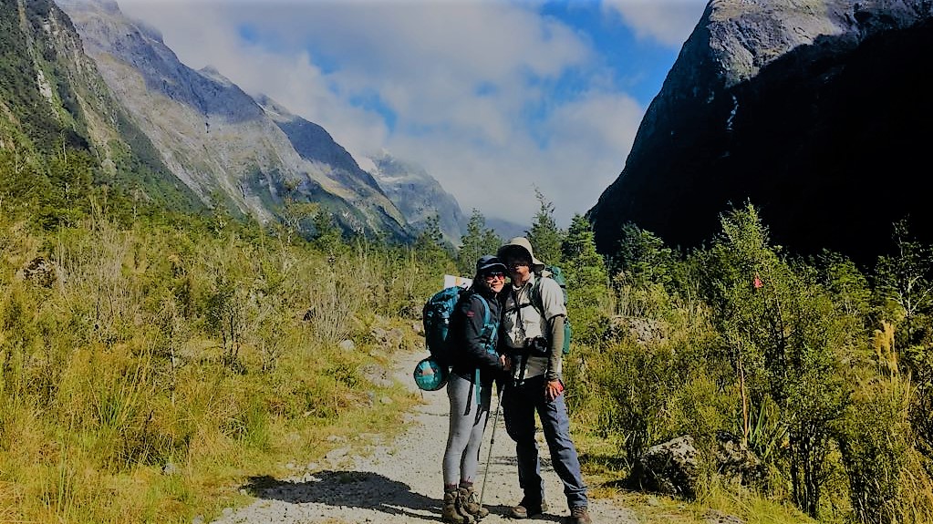
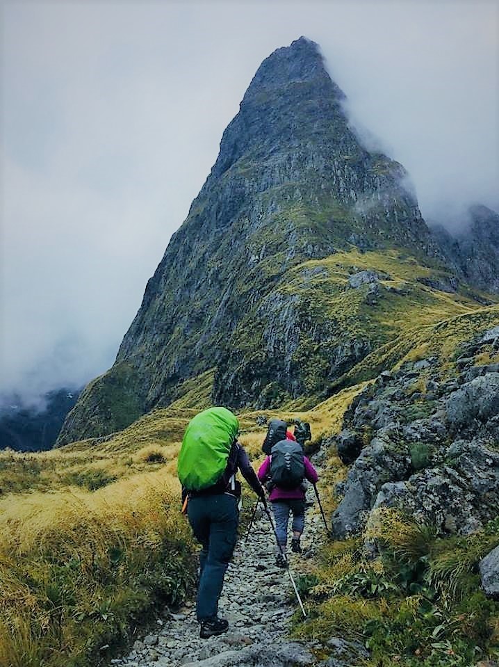
The third day was the most strenuous not only because the climb was steep leading to the highest point called McKinnon Pass but more due to a bad weather condition. There was a torrential rain in the morning so we decided to get cracking just before midday to make sure that we progress through the tracks safely. It was cold. The trail was slippery. There was quite a strong gust of wind in some places which was an advantage as it propelled the thick fogs and clouds away from the panoramic views that fired our bellies to witness.

Anyway, Day 3 was a 14 km hike from Mintaro Hut, going past the peak with an elevation of 1,154 meters, to Dumpling Hut with an average hike time of 6 to 7 hours. Again with a few of us who were gifted with the ability to walk slower than the others, a couple of hours was added to the time frame. Good, we were not running a race but we had to get to the next hut before the light faded out.

We stopped at McKinnon Pass Shelter which was just a short descend from the peak. Here, we took some time for a recess. The shelter has two rooms. One is for the guided hikers and the other one is for independent walkers. A few feet away from the shelter is a long drop toilet- a restroom with the most picturesque view in NZ!
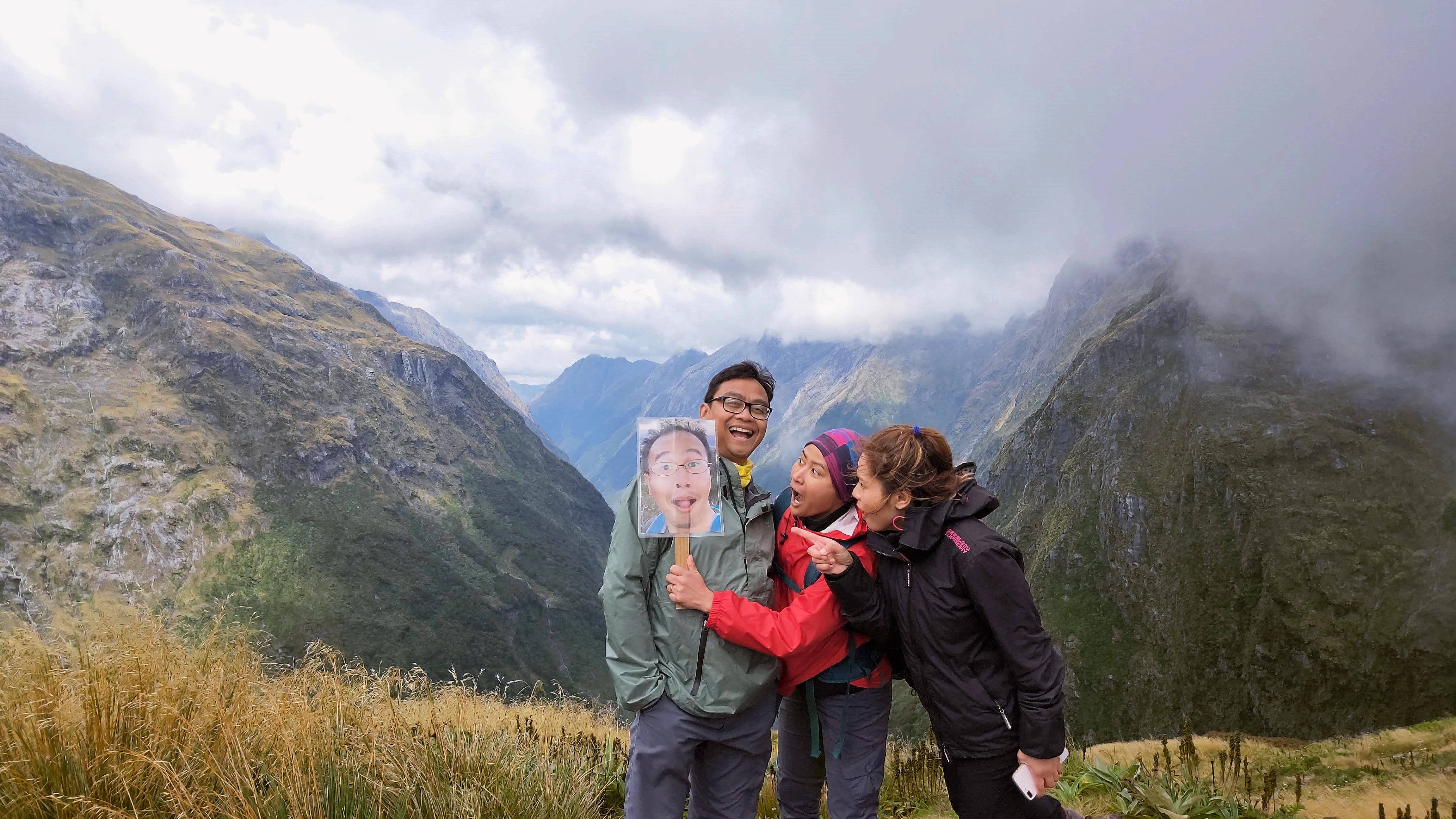
It took us a while to get photographs in this site because the clouds were covering the alpines and the valleys at intervals. Thanks to the wind blowing! Despite the not so good weather at that time, we were able to get a glimpse of the views.
Descending from the Pass was more than challenging than ascending it. We had to steadily move down the steep mountain. Our knees and feet were quietly protesting against the rugged terrain but our eyes were incessantly ravishing at the grandeur of the surroundings.

Further down, we walked side by side cascading water falls, the Roaring Burn Fall in particular and passing several others. A side trip to Sutherland Falls before reaching the Dumpling Hut is worth the effort. It is the highest waterfall in NZ at 580 meters. I have not done it as I contented myself from viewing it from afar and time was not enough to beat the sunset but my friends who had the chance to do the detour had common amazing descriptive words about it.

Day 4 was both a bit of a pressure and a challenge to our endurance. We had to catch a water taxi Beah booked for us at 2pm! That was the pressure! With our feet sustaining a few little blisters the day before and the knees that had not fully recovered yet, an early start was necessary to finish the 18 km track in a suggested time of 5-6 hours. We did endure that though.

With some energy left, we trudged (although we aimed to be a little faster) the rock-ribbed path to Sandfly Point. Thankfully, the trail was mostly leveled. En route are a few water falls. The more popular are the McKay Falls and the Giant Gate Falls. The latter is located near the end of Milford Track.

Yes, Sandfly Point it was! As its name suggests, you surely have a good idea why it is called as such. This is where we completed the Milford Track! But the great illustrations of Milford’s wonders does not end here.
A water taxi took us from Sandfly Point to Milford Sound. That was an exciting 5-minute ride!

Quite exhausted, mildly sore, a bit limping and hungry, we went to a cafe where I crashed on a chair just hankering for a proper meal and a hot shower. A meal I had, yes. But a hot shower was still to come until we got to Wanaka! That was 5 hours away from Milford Sound! Whew! Nonetheless, I felt a sense of achievement for ticking off another great walk in my list! More than that however, I got a high on guffawing and the shaggy-dog stories my friends and I shared. These were priceless! Not to mention we’re off social media for a few days!
Before I conclude my hiking tale, let me tell you something about Milford Sound… just briefly. Milford Sound, another must-see in NZ is one of the world’s top travel destinations. A fiord and in NZ’s one of the remotest locations, it invites many visitors around the world just by its sheer beauty. However, for those who are ATM post devotees on social hypermedia, sorry there is no mobile phone network coverage here! And if you are planning to drive all the way to Milford Sound, make sure you have enough petrol on your tank!

you are very adventurous and you have a very good team for long walks you do. The photos are beautiful.
LikeLike
Thank you Zube. I’m trying to get the balance. We all need it 😃
LikeLiked by 1 person
Now that’s what you call living the dream my friend. Another very very good, informative blog… well done!
LikeLiked by 1 person
Thank you my friend.
LikeLike
Dora’s Thought Hub, let’s you to think even bigger about the Milford Track. Keep posting good stuff. Thanks for serving. https://www.alpineviewmotel.co.nz/
LikeLike